Watershed Education
ACWA’s efforts are focused in two main watersheds located in Washington County, Maryland, but we do support other projects outside our watershed’s boundaries.

Our Watersheds:
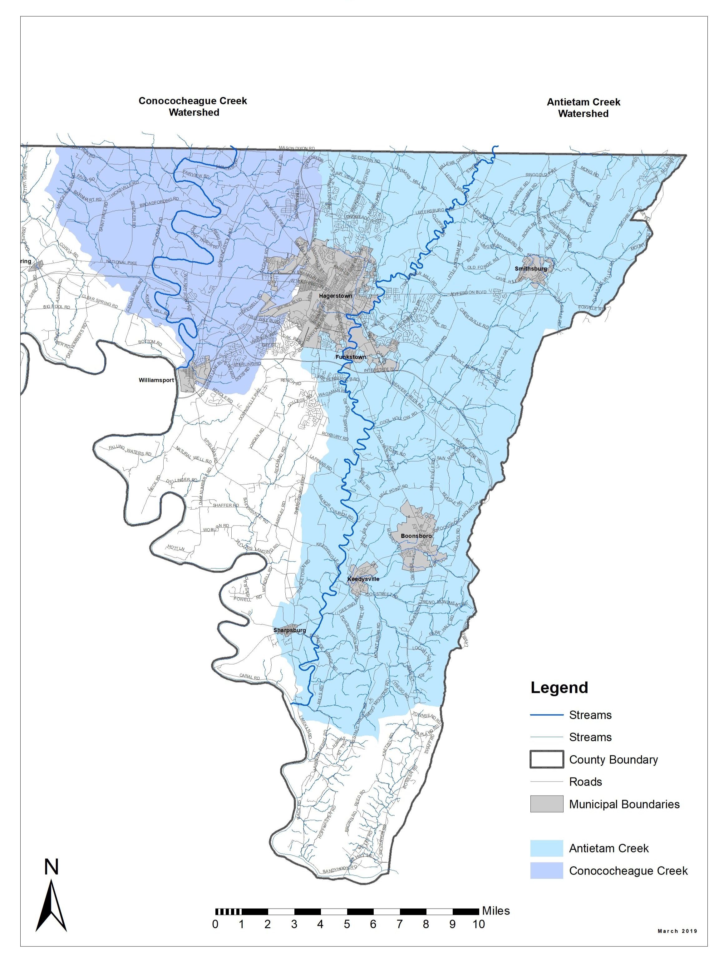
-Antietam Creek watershed (shaded in light blue on map, left) begins in Pennsylvania in Adams and Fulton Counties. The Creek mainstem is approximately 54 miles in length, with 37 miles in Washington County. The Antietam discharges into the Potomac River at the Antietam Aqueduct on the C&O canal near Sharpsburg. The land drainage area (the watershed) within Maryland covers 187.0 square miles (~118,400 acres). [MD 8-Digit code: 02140502]
Antietam Watershed Restoration Plan Approved on March 30, 2011 (MDE Website)
Water Quality and Watershed Health Info, visit “How’s My Waterway” for the Antietam (USEPA Website)
-Conococheague Creek watershed (shaded in light purple on map, left) lies in its majority in Pennsylvania, with only 65.8 square miles in Washington County, west of Hagerstown. The length of this lower creek section is 22.0 miles. The creek discharges directly to the Potomac River at Williamsport, Md. [MD 8-Digit code: 02140504]
Educational organizations throughout the Chesapeake Bay Watershed help citizens gain the knowledge and tools to make informed water and land use decisions which protect and restore the integrity of their local watersheds. Click each organization’s logo to learn more…


